
(This is the Lesson Plan 1 for Rose Honey’s curriculum, “Discovering Our Relationship with Water.”)
ANDERSON, 2013
A. LEARNING OBJECTIVES
- Models/maps can communicate many different kinds of things.
- Documents can be used to record events, times, locations, and landscapes including mountains, valleys, rivers, and the places where we live.
- Water connects us to people and places in the world.
- Tribes have place names for many of the locations where Lewis and Clark traveled.
B. LESSON PLAN DESCRIPTION
In May of 1804, Lewis and Clark and the Corps of Discovery went on a journey. They were asked by the United States government to look for a water passageway from St. Louis to the Pacific Ocean. One important way that they did this was to look at documents and maps that had already been made, using knowledge from Native American tribes and others (like hunters and trappers) who had traveled on their route. In the beginning of the journey, Lewis wrote in his journal, “Set forward to that village in order to join my friend companion and fellow laborer Capt. William Clark, who had previously arrived at that place with the party destined for the discovery of the interior of the continent of North America” (Lewis, Clark and Members of the Corps of Discovery, 2002).
The title of this expedition may contain the word “discovery,” but there were many people already living in the places where they were traveling, and many of the land features and waterways had already been documented and named (Restoring Our Names, 2009). Lewis and Clark talked with many Native American tribes along their journey, who helped them to learn about the landscape, and to decide which waterways or land routes to take.
Starting this curriculum by teaching the idea of where the water is in our community will introduce the idea and give an understanding of spatial relationships. Through searching on maps for bodies of water (lakes, rivers, ocean, etc.), creating maps as a class, and visiting locations on a map, learners can begin to connect these documents with the world around them and to explore the many ways in which water connects us all.
C. MATERIALS
- Various examples of ways in which people document events, time, landscapes, etc. like winter counts, Lewis and Clark journal entries, calendars, etc. For examples of winter counts, go to this Lakota Winter Counts exhibit at the Smithsonian National Museum of Natural History (2012) or this curriculum (South Dakota Public Broadcasting, 2013).
- Maps: globes, flat maps of the world, topographical maps, city maps, subway map, bus route map, river maps, etc.
- Large sheets of flip chart paper or butcher paper, markers
- Individual Discovery Journals for students
- Internet access to look at documents such as Winter Counts. Two resources are Smithsonian National Museum of Natural History (2012) and South Dakota Public Broadcasting (2013).
D. CIRCLE TIME
Spread the documents (calendars, winter counts, maps, journals, etc.) out onto the floor in the middle of the circle. Ask the children: What do you see? What do you notice or wonder about when you look at these documents? If there are no questions, model asking questions. What kind of story does that blue color that you see here (point to lake, river, or ocean on map) tell us? What story does that animal (point to symbol on winter count) on this document tell us? Does anyone have a guess? Give them time to think about it and allow for questions. Direct the conversation to the maps. What do you see on this map? What else do you observe? Can you identify the water on this one? Emphasize that maps are documents that represent towns, roads, or natural features such as mountains and rivers and that they can show us how we are connected to other places in the world. Watch videos and read books (listed below) on the water cycle, and where our water comes from (rain, rivers, melting snow from the mountaintop, etc.). Talk about the idea that water starts as rain or snow high in the mountains and trickles down to small streams, then to larger rivers, and finally the ocean. Discuss the idea that water connects us to these places, and that when we touch water, we are connected to every place in the world.
Talk about Lewis and Clark and their journey using water to travel to the ocean. Show them a map of Lewis and Clarks Journey. Point to where Lewis and Clark started their journey, and have the children do the same. Next, ask them: If you used the water as your highway, how would you travel to the Pacific Ocean?
Guide the students to some water (either inside of the classroom or outside). Ask them to touch the stream of water from the faucet or hose (or river or pond). Discuss where this water comes from by asking the students, “Where do you think this water came from?” Ask them to take a guess (use the word predict) about where the water traveled from, and where it is traveling to next.
Videos
Focused on where water comes from and where it is going.
- The Water Cycle Rap (Cottenham, 2010)
- The Life of Water. Water Which Gives Life (Water Project H2Ooooh!, 2010)
Discovery Journals
Ask the students to think about their relationship with water in their daily lives. Prompt them to think about this by saying things like, “Have you touched water today? How did you come in contact with water today? Did you drink it? Did you use it to wash? Did you play with it?” Pre-write in their Discovery Journals at the top of the page, “What has been your relationship with water today?” Discuss this question with the group, then ask them to draw a picture that represents this, or help them to write words like, drink water, brushed teeth with water, cooked with water, walked through a puddle of water, etc. in their discovery journal.
Books to Read
- Water, Water Everywhere [Book 1] (Overbeck and Rauzon, 1995)
- As the Crow Flies: A First Book of Maps [Book 2] (Hartman, 1993)
- Book List
E. ACTIVITIES
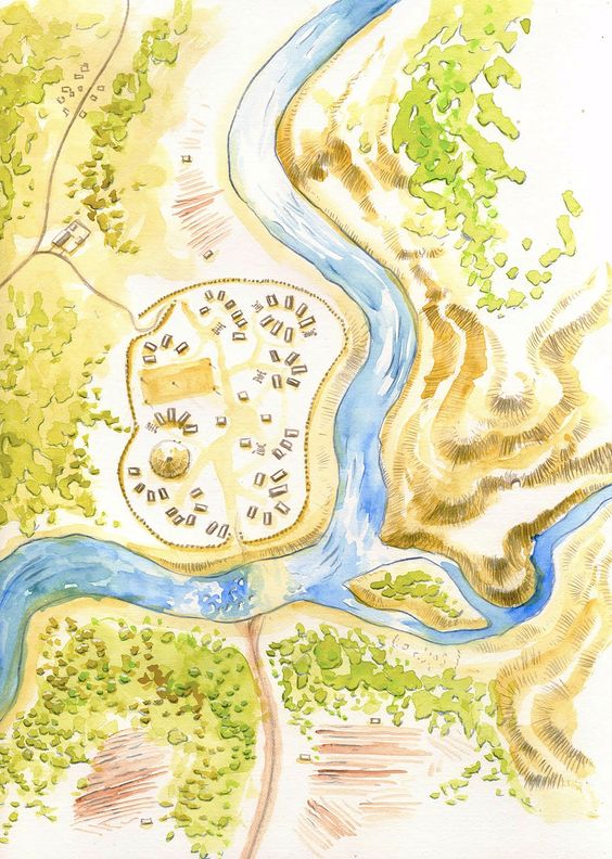
![]() Inside Activity
Inside Activity
Mapping Our Community
This particular activity is designed to lead students towards asking questions about water. Where is the water in our community? Where does it come from? How does the water in our community get into our faucets? Where does it go from there? These activities will encourage learners to think about the places where they live and their place within their community as well as how everything within their community (and the world) are connected. Jane Goodall’s Roots and Shoots(2012) inspired this activity.
Drawing Maps
Introduce the idea of a map to students. Ask them what they think a map is? What are maps trying to communicate? (You may have already gone over this during the circle time.) Then, ask students to explore on their own by drawing a map in their discovery journal. Allow them to draw whatever type of map they would like to draw. Try not to give them preconceived ideas about what a map is (this initial map drawing can be utilized for assessment later on).
Community Map
Next, guide the students towards drawing a large map together of the community that you all live in. Once you decide together on what to include, tell the students, “Now we have collected data on where the water is in our community. We are going to communicate these results on a map.”
Research Question
Where is the water in our community?
- On a large piece of flip chart paper, draw the boundaries of the area. “Let’s think about drawing a map of where we live. What kinds of questions do we need to ask before we begin to draw our map? What kind of data should we gather?”
- Guide the students to identify areas of importance for people, animals, the environment, and don’t forget to focus on where the water in your community is, and how to represent it. “What shall we include in our map? Do we want houses in our map? Our school? The mountains?”
- Focus on the water in the community for this map by asking the following questions and encourage the children to formulate their own questions:
- Where does the water that you drink come from on this map?
- When you take a shower/bath, where does the water go after it travels down the drain?
- If it is raining outside, can you show me on this map where the water goes?
- Where do you like to go swimming?
- When animals are thirsty, where do they go to get a drink (birds, deer, cows, frogs, etc.)?
- Where else is there water on this map? Where does it come from?
- Record the answers to these questions on your community map. Try to draw a feature on the map for each idea the learners provide. Even if a child says that water goes “into the ground,” or “in the air” indicate this on the map somehow.
- Introduce the map of Lewis and Clark’s journey to the students. Talk about how Lewis and Clark were looking for a waterway to the Pacific Ocean, and how the tribes along their journey helped them to decide what rivers to travel on. Ask the students: What do you observe/notice about this map? Where on the map do you think Lewis and Clark might have traveled? How do you think Lewis and Clark might have traveled? If Lewis and Clark traveled on water, what path do you think they took? Can you show me the path with your finger?
Emerging Learners
If you feel that your classroom or specific children in your classroom need an activity prior to drawing a map of the community, try drawing a map of your classroom together. Use simple drawings of real items like sinks, desks, chairs, etc. to represent the location of items in the classroom. Using the classroom map or the community map, focus on spatial concepts. For example, “Let’s look at the map. Where is the river on this map? Does the river go above the town or below the town? Is the lake between the mountains or under the mountains? Early Learners are beginning to understand the concept of space and their environment. Engaging them in language that describes spatial concepts will help them to develop this understanding (Spivey, 2009). Use words like over, under, on top of, below, between, in front of, behind, etc. to help children develop spatial intelligence.
Advanced Learners
Advanced learners can also begin to think about relationships between symbols and objects in reality. For example, instead of using a blue line or a blue circle to represent water, use a dotted line, or an X to represent water. This pushes the learner to distinguish between alternate forms or representations and can help children to develop skills for things like problem solving (Goria and Papadopoulou, 2008).
Helpful Hints
- Research shows that an awareness and understanding of spatial concepts and relationships can predict later success in math, reading, and in following directions (Spivey, 2009).
- On the community map that you draw with your students, it might be helpful to place different colored stickers, or use markers to color in different areas to indicate areas of importance. For example, place blue dot stickers in areas where water needs to be represented, and brown dots where forests are.
- For students who are having trouble thinking about the classroom or the community in a 2-dimensional space, it might help them to create a 3-dimensional representation of the room or the community with your students. Use materials such as blocks or empty boxes for houses, small branches or plants for forests, and blue cellophane, felt, or clay to represent the water in the community.
![]() Outside Activity
Outside Activity
Visiting Water in Our Community
- Visit one of the places on the map that you drew together (Ideally, this will be a location that Lewis and Clark traveled through). Remind students of the map you drew together and show them where you are going on the map. Next, look at a professionally drawn map of your community and ask the learners to point to the water in this map. Talk with them about where this water came from and where it’s going.
- Listen to the audio story by Julie Cajune, talking about what the rivers meant to the Salish people. It is titled “Salish Water Highways.”
- Once you arrive, look at the maps again and help students to connect features of the landscape to them.
- If you know or can find the tribal place name, talk about the current local name for that place and the tribal place name that it used to be called. How did the location get these names? What is the difference between the two names? Is there any connection between the two names? Utilize the Honoring Tribal Legacies Place-Name table to find names for your location. For example, the place name for Missoula where the Clark Fork River flows was originally called Nmesuletkw by the Bitterroot Salish people, which means place of the very cold water. It is now called the Clark Fork River, which is named for William C. Clark of the Lewis and Clark Expedition.
- Ask students to draw another map on a new page in their Discovery Journals. Share and discuss these maps as a group. Ask students what “place name” they would call the location where you are.
F. SUGGESTED FORMATIVE ASSESSMENT
- Ask students to describe the maps they drew in their journals (in the beginning of this episode).
- During discussion about the community map, question students about features of the map and be attentive to who responds.
- Ask students to identify the water on their classmate’s maps.
- Draw a simple map of your classroom. Point to a place on your map and ask a student to go stand there in order to assess their understanding of maps as models or representations of a place.
G. BIBLIOGRAPHY AND RESOURCES
Anderson, D. (2013). Blue Boxer Rebellion: The Town of Chisca. Retrieved from http://blueboxerrebellion.blogspot.com/2013/04/free-map-town-of-chisca.html
Cottenham, A [Alexcottenham]. (2011, January 18). The Water Cycle Rap [Video File]. Retrieved from http://www.teachertube.com/viewVideo.php?video_id=230786
Gloria, S. and Papadopoulou, M. (2008). Preschoolers Using Maps: An Educational Approach. The International Journal of Learning p. 173-186, 15(8).
Hartman, G. (1993) As the Crow Flies: A First Book of Maps. New York, New York: Aladdin.
Jane Goodall’s Roots and Shoots (2012). Mapping My Community.
Lewis, M., Clark, W., and Members of the Corps of Discovery. (2002). May 20, 1804. In G. Moulton (Ed.), The Journals of the Lewis and Clark Expedition. Lincoln: University of Nebraska Press. Retrieved April 25, 2014, from the University of Nebraska Press / University of Nebraska-Lincoln Libraries-Electronic Text Center, The Journals of the Lewis and Clark Expedition website: http://lewisandclarkjournals.unl.edu/read/?_xmlsrc=1804-05-20.xml&_xslsrc=LCstyles.xsl
Overbeck Bix, C. and Rauzon, M. (1995) Water, Water Everywhere. San Francisco, California: Sierra Club Books for Children.
Restoring Our Names (2009). A Native View from the Cayuse, Umatilla and Walla Walla Homelands. Retrieved from: http://www.digitalcultures.com/ctuirMap/
Smithsonian National Museum of Natural History (2012). Lakota Winter Counts: An Online Exhibit.
South Dakota Public Broadcasting (2013). Waniyetu Wowapi (Winter Count). Retrieved from http://www.sdpb.org/wintercount/
Spivey, B. L. (2009). What are Spatial Concepts and Relationships? Super Duper Handy Handouts! Retrieved from http://www.superduperinc.com/handouts/pdf/240_SpatialConcepts.pdf.
Water Project H2Ooooh! [UNESCOVenicOffice] (2010, August 18). The Life of Water. Water Which Gives Life [Video File]. Retrieved from http://www.youtube.com/watch?v=FAnDlYRycqs