Sharing information—Nazareth | Oliver Shalabi
How to compensate the disadvantage of original urban planing and respond to the local environment is also the target of designer. The project sits on the border between 2 cities, Nazareth and Nazareth illit. Both cities lie in the northern region…

Wood Joinery
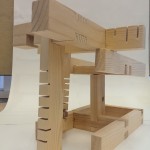
This is the pictures from my wood joinery later done in the class. It is a wood stand with adjustable angle to support my metaphor. Instead of having the metaphor sitting on top, I have it up-side-down to blend…

Metaphor – Wai Ching
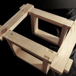
In the first version of my metaphor, I would like to represent the different aspect of my program into three similar geometries, each represents the different characteristic and quality of my user space. They are unified together with…
South [Maker]Factory
A current draft of my prep book: [embeddoc url=”https://blogs.uoregon.edu/arch586s16cheng/files/2015/12/Draft-26qmy80.pdf” download=”all” viewer=”google”]
Site Vision
[embeddoc url=”https://blogs.uoregon.edu/arch586s16cheng/files/2015/11/Joehudec_sitevision-2mqcyic.pdf” download=”all” viewer=”google”] SITE VISION_ In Portland, there is a long history along the shores of the Willamette River. The past was once a time of big industry on the water. As times change and technology advances, we see…

Portland Zoning and Data
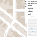
A snapshot of a few relevant resources and datasets available on the City’s website. civic apps open data: GIS files of datasets from various public agencies–everything from building footprints to streetlight/ street tree locations portland maps metadata: good basemap/ satellite images of the city,…
Making, Learning, Engaging
The “Clinton Triangle” on the south side of the new Clinton St/ SE 12th Ave MAX station is one of many blocks in Portland’s Southeast Quadrant that is lacking in density and activity–both economically and culturally. However, with recent investments…
