#4 Assignment for Friday: Project Maps + Documentation
2 person project
- Image on-site highlighting the qualities that you are looking at.
- Precedent project image highlighting the qualities that you are looking at. (High or Low)
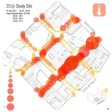
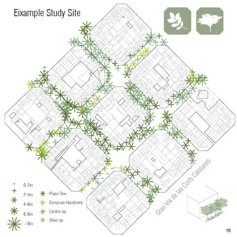
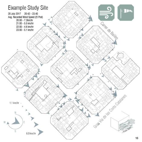
- Use the GIS VIZ tool to create 2D plans of each quality/indicator. Plan, name, icon, scale/data dictionary


- blog category [04 Project Maps]
Class documentation
- Printout your work 11×17 (1-2 pages)
- blog category [02 GROUP SITE ANALYSIS]
Review 01 DOCUMENTATION on Google Drive

