Meet Our RARE AmeriCorps Participant: Rithy Khut

Rithy Khut RARE AmeriCorps Resource Assistance for Rural Environments Multnomah County

About Rithy Khut

Rithy received his Bachelor of Science in Environmental Studies with a minor in Political Science from the University of Oregon.  Rithy continued his education at UO and earned a Master’s in Community and Regional Planning. Rithy has worked for the University of Oregon Outdoor and Bike Program as both the Office Coordinator and the Business Operations Coordinator. Following his year with the RARE AmeriCorps Program, Rithy hopes his time with RARE will open up a wider range of employment opportunities for him as he narrows down his career preferences.

About Multnomah County Land Use and Transportation Planning Division

Multnomah County is the smallest county (465 sq miles) in the State of Oregon with the highest population (742,000).  Within Multnomah County are six cities in 183 square miles of the county: Portland, Gresham, Troutdale, Fairview, Wood Village and Maywood Park.  The remaining 282 square miles in the county is rural farm and forest land on both the east and west sides of the metropolitan area.  Within this area, there are five unique rural planning areas: Sauvie Island/Multnomah Channel, West Hills, West of Sandy River, East of Sandy River and the National Scenic Area in the Columbia River Gorge. Multnomah County has approximately 4,000 employees, 200 of which work within the Department of Community Services

In response to and building off the work from a previous RARE participant on the Sauvie Island/Multnomah Channel Rural Area Plan (RAP) update, the county proposed an update to the wider County Comprehensive Plan and Transportation Systems Plan (TSP). The Comprehensive Plan identifies land use and transportation planning goals, policies and strategies that protect natural resources and guides development primarily within the unincorporated rural areas of the county. Rithy is placed with Multnomah County Land Use and Transportation Planning Division where he will work with a team of individuals to develop and conduct a transparent and inclusive public engagement process specific to the Comprehensive Plan and TSP update process; further define data needed to meet Goal 2 requirements of the Oregon Land Use Planning Goals; and, help with the overall preparation and compilation of the aforementioned planning documents.

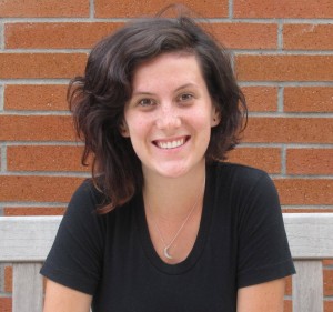
Meet Our RARE AmeriCorps Participant: Maia Hardy

Maia Hardy RARE Resourse Assistance for Rural Environments

Maia Hardy received her Bachelor of Science in Urban and Regional Planning and Non-Profit Management from Eastern Michigan University. In her last few months as a student, Maia was as the Ypsilanti Representative for the Millennial Mayors Congress where she met with elected officials and civil leaders to discuss pertinent and pressing issues facing the Detroit-metro region. As s student, Maia was also selected for a number of competitive grants, internships and research opportunities. After realizing her passion for planning and community development, Maia decided to dedicate herself to serving communities in need, making her a perfect fit for the  RARE AmeriCorps  Program – Resource Assistance for Rural Environments

In response to the growing number of issues raised by citizens and stakeholders in the Sauvie Island/Multnomah Channel planning area, staff, in coordination with CH2M Hill, conducted a significant outreach and scoping effort to identify land use and transportation issues that should be addressed in a future update to the Rural Area Plan (RAP) and Transportation Systems Plan (TSP). Maia with the Multnomah County Land Use and Transportation Planning Division will work with a team of individuals to develop and conduct a transparent and inclusive public engagement process specific to the RAP and TSP update process; further define data needed to meet Goal 2 requirements of the Oregon Land Use Planning Goals; and, help with the overall preparation and compilation of the aforementioned planning documents.
Multnomah County is the smallest county (465 sq miles) in the State of Oregon with the highest population (742,000). Within Multnomah County are six cities in 183 square miles of the county: Portland, Gresham, Troutdale, Fairview, Wood Village and Maywood Park. The remaining 282 square miles in the county is rural farm and forest land on both the east and west sides of the metropolitan area. Within this area, there are five unique rural planning areas: Sauvie Island/Multnomah Channel, West Hills, West of Sandy River, East of Sandy River and the National Scenic Area in the Columbia River Gorge. Multnomah County has approximately 4,000 employees, 200 of which work within the Department of Community Services

Organization: Multnomah County Land Use and Transportation Planning Division
Community: Rural Area outside Portland Urban Growth Boundary- Sauvie Island/Multnomah Channel
Population: 1,300 (Suavie Island)
County: Multnomah