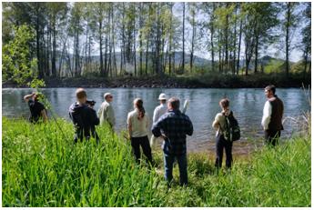
A Walk in the Woods by Scarlett Philibosian
What is healthy riparian habitat along the McKenzie River? Is it a lot of trees lining the banks of the river? Do they have to be native tree species? How far from the waterway does riparian habitat extend? What about plants growing close to the ground?
My Community Planning Workshop (CPW) team is working with the Eugene Water and Electric Board (EWEB) and local organizations to find the answers to these types of questions. Talking about what makes up a healthy riparian forest is part of our work in designing a project called the Voluntary Incentive Program (VIP). Under this program, EWEB will reward landowners who maintain healthy riparian forest habitat on their land. The program is designed to build positive community relationships, both among neighbors in the lower McKenzie River basin and between landowners, EWEB, and partners in the VIP such as the McKenzie Watershed Council.
Most people living in Eugene drink McKenzie River water, and the VIP will incentivize maintaining land next to the River  in ways that translate to better water quality. But what exactly constitutes habitat that will filter pollutants out of water? To find out, my CPW team visited the Bergrenn Demonstration Farm, and walked around different types of riparian land. Here are several pieces of information we learned from VIP partners about riparian forests along the McKenzie River:
- While nonnative plant species do take up pollutants from the water, some provide less of a filtration service than native species. For example, the invasive reed canary grass (top picture) has shallow roots, while native clumping grasses have deep root systems that anchor soil and pull pollutants from several feet beneath the surface. Therefore, minimizing nonnative species on riparian land is important to maintaining good water quality.
 The canopy of larger trees tend to take up more surface area than do smaller trees. Canopy cover over the river banks helps slow down the speed at which rain falls on the ground, which reduces erosion and therefore reduces sedimentation, a type of pollution.
- Leaf-fall and rotting logs results in a rich topsoil layer above the finer soils. This layer provides habitat for burrowing creatures such as insects and salamanders, and burrowing makes soils more porous.
- Lastly, different native plant species work in harmony to take up pollutants and protect the riparian land from severe flooding. Therefore, maintaining many different plant species in the riparian zone is important to good water quality.
Other posts about Scarlett Philibosian
More about the Community Planning Workshop(CPW)

