

![]()
About
During my time as the Peter R. Gould Center for Geography Education and Outreach undergraduate intern, the main cartography lab of Penn State Geography, I had the honor of serving as the de facto principal cartographer for the national project to nominate 10 US buildings designed by famed architect Frank Lloyd Wright. The primary stages of the project lasted about 1 year and involved me producing a myriad of maps for sites scattered throughout the US. We relied on the mishmash of publicly-available and private data, in addition to manually produced data to support the nomination. I had a co-student cartographer, Hilary Clauss, during the initial stage of the project, but ultimately became the sole project cartographer for much of the project duration. The project was conducted under the watchful eyes of Dr. Cindy Brewer, my advisor, who served as the director of the Gould Center before becoming Department Chair. Ultimately, only 8 of the original 10 nominated sites were successfully inscribed by UNESCO. These 8 sites were inscribed to the World Heritage List in 2019.

Abstract
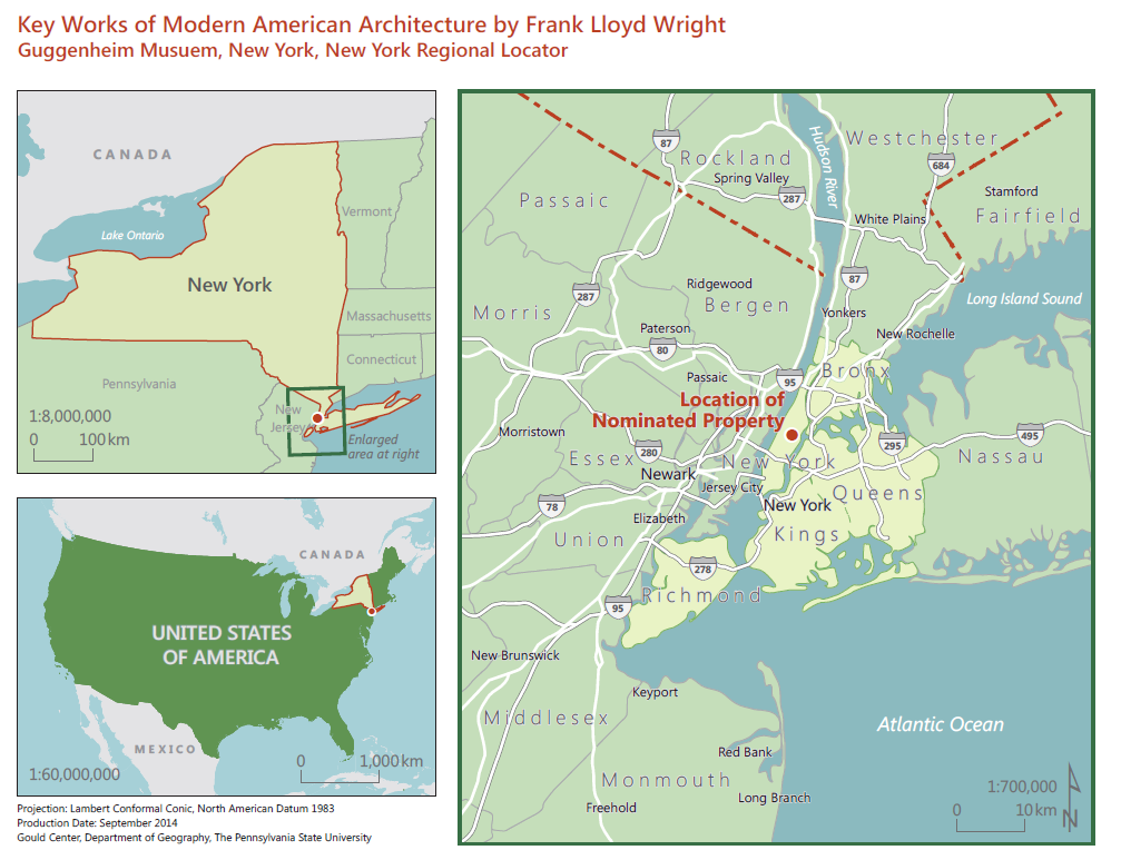
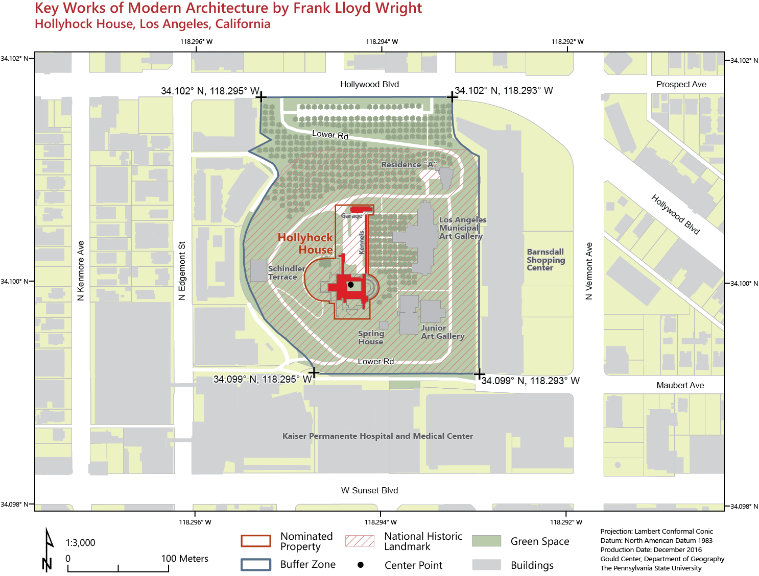
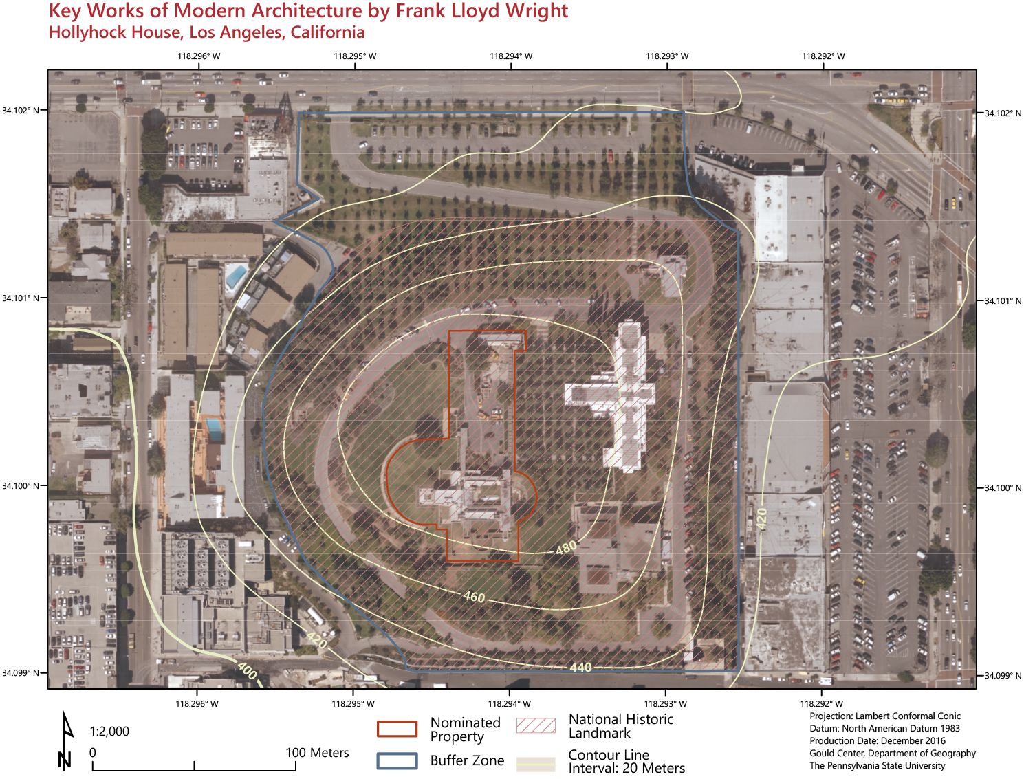
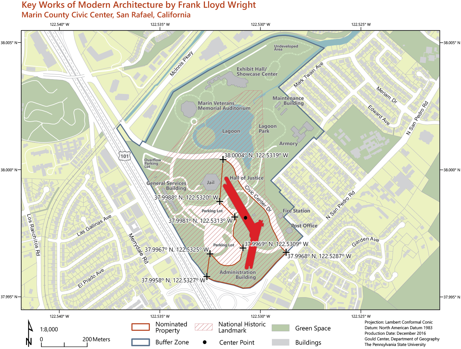
We prepared a series of maps to support the application for a collection of Frank Lloyd Wright buildings across the United States as UNESCO World Heritage Sites through the National Park Service. The project was a challenge because sites were geographically dispersed and varied in size. Base data required for large scale mapping varied widely in availability and detail. Sites in dense urban areas had parcel data available and others did not. For sites in rural areas, general zoning data serve the role of parcels. Open source and hand-compiled data were used to support missing or incomplete content. National Map data were used for smaller scale mapping. We merged data from numerous sources that varied in compilation scale and completeness to produce coherence across the map series. Since the maps fit into a longer report, a color palette and design guidelines were provided by the client’s dossier designer. We worked to follow this guide while maintaining contrast and color relationships through scale among inset maps and among elements such as roads, boundaries, open spaces, building categories, and water features. Using GIS for map design was important since personnel at many sites worked through deciding the extent of buffers around the historic locations as they saw the draft maps. Thus, we repeatedly revised latitude/longitude annotations and recalculated property and buffer areas. These maps were completed amongst the press of coursework for the students , meeting rapid-edit requests and communicating clearly with client groups at regional non-profit and federal agency levels.
Selected Maps
Related Publications
- Published conference proceedings paper on the project
- Overview poster on project
- Cartographic poster of project
- Published nomination “dossier” book by the Frank Lloyd Wright Building Conservancy and US Park Service
More Details