Revegetation Objectives
The restoration project objectives were: 1) minimum stem density of 4,000 native stems per hectare, 2) stem diversity including a minimum of five tree species and eight shrub species, and 3) invasive vegetation be reduced or controlled to less than 25% ground cover within five years of project completion.
In order to determine the success or failure in meeting these objectives, our team sampled a subset of the project area floodplain to measure vegetation cover.
Sampling Methods
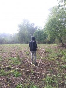
We used a modified version of The Freshwater Trust’s (TFT) Revegetation Monitoring Protocol for Water Quality Trading Projects to monitor the vegetation at BWCA. We re-visited 15 transects that were randomly-selected and established in 2015. In order to ensure samples were a valuable representation of the entire planting area, samples were taken in intervals along all 15 transects. We plotted 6 m x 6 m square plots, centered on the transect with 6 m spacing between each plot along the length of the transect. Throughout the entire 6 m square plot, our team recorded the species code and number of each tree and shrub species above 0.15 m in height. We used two 1 m x 1 m subplots within each plot to sample ground cover composition. We recorded the percent cover of different types of invasive vegetation (e.g., woody, grass-like or herbaceous), as well as ground substrates (e.g., bare soil or thatch). Recording the relative composition of the ground cover is necessary for analyzing trends of invasive species growth relative to surviving native species at BWCA. Our team also recorded general observations on soil characteristics, natural native vegetation, health of vegetation project plantings, and any debris from recent flooding events.
Additionally, we sketched a map of each transect layout and recorded vicinity to important landmarks This monitoring protocol enables adaptive management of BWCA, bringing awareness to aspects of the project that are successful as well as ways to constantly improve restoration practices.


