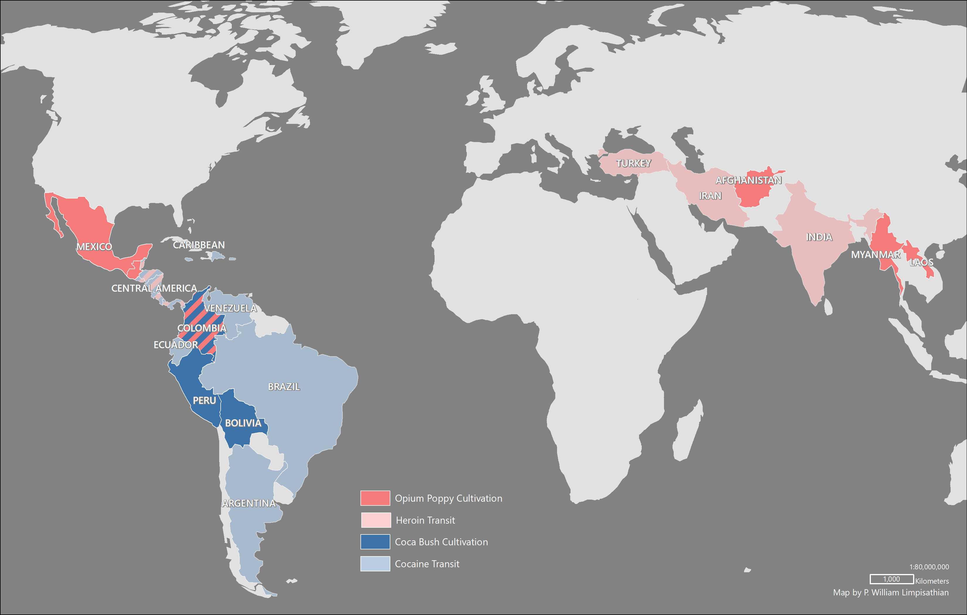
In March 2017, I produced these maps to support the research by my former colleague at Penn State, Gabriel Tamariz, on the international cultivation and trade of opium poppy and coca bush. The maps were produced using ArcGIS Pro with manually modified data sourced from Natural Earth. These maps were exported from ArcGIS Pro into Adobe Illustrator for additional symbolization.


