Welcome!

welcome_pic2

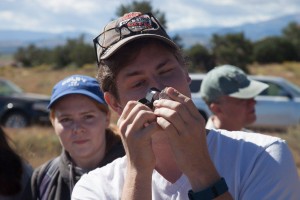
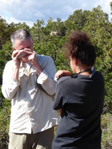
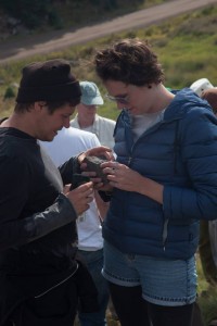
Greetings from the Land of Enchantment and Colorful Colorado!

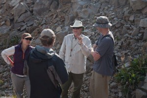
Welcome to the semi-official blog following the adventures of a group of graduate students and professors from the Department of Earth Sciences at University of Oregon (UO). We are also privileged to be in the company of USGS researchers from the “Cenozoic Landscape Evolution of the Southern Rocky Mountains” project, who are highlighting their latest findings which are transforming our understanding of this region of Northern New Mexico and Southern Colorado. Our trip leaders are Dr. Mike Dungan (UO) and Dr. Ren Thompson (USGS), who have been working in this unique part of the world for decades, since Ren did his PhD research in the area under Mike Dungan.

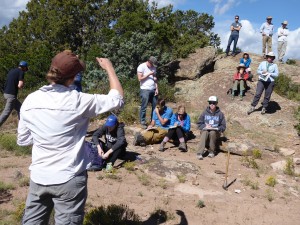
This is a Staples’ Field Trip, which is supported by a fund in honor of Dr. Lloyd W. Staples, who spent his career as a Professor of Geological Sciences at UO, and has supported UO excursions to incredible geologic locations near and far. From the mouths of our esteemed trip leaders, the aim of this trip is to provide

a  synthesis of  accumulated knowledge and our collective contributions  to an understanding  of  the  Oligocene‐to‐present‐day  evolution  of  the  northern  Rio  Grande  Rift  and  the voluminous Oligocene calc‐alkaline volcanism that preceded the onset  of rifting. The underlying theme of this trip is how volcanism and tectonic setting changed in relation to each other over the last 35 Ma, and  this  will  be  explored  on  the  basis  of  physical  volcanology,  rift‐basin  structure  and  volcano‐sedimentary  stratigraphy,  a  wealth  of  new  geochronologic  and  geophysical  constraints,  landscape evolution, and igneous petrology. This trip will feature the integration of different types of information to develop a regional perspective, and insights gained from iconic examples of geologic phenomena.

Whew – quite a endeavor!    Follow this blog to see how our geologic enlightenment turns out!

note: the oldest posts are at the bottom of the page

Visit the rest of our department at: http://earthsciences.uoregon.edu/

Check out the USGS project page on the Southern Rocky Mountain volcanism: http://gec.cr.usgs.gov/projects/srm/volcanism.shtml
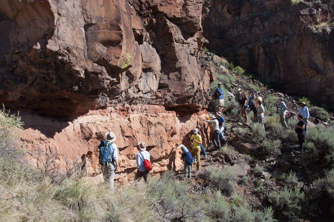
Day 7 – Great Sand Dunes + Departure

Despite our trip reaching its formal conclusion, we snuck in one last (amazing) geologic experience: Visiting Great Sand Dunes National Park. A crook in the line of Sangre de Christo Mountains has allowed strong westerly winds blowing pleistocene Lake Alamosa sediments to form a vast accumulation of sediments. Small rivers around the margins of the dunefield help keep the sand tightly confined, growing to over 200 meters.

We spent our final morning playing in this dramatic interaction of Precambrian / Laramide uplifted Sangre de Christo mtns, eroded San Juan material, paleolakes and modern winds. We then spent the afternoon picking sand out of everywhere during our egress to the airport. A great trip conclusion!

Great Sands and the Sangres in the distance

Great Sands and the Sangres in the distance

Day 6 – The Central San Juan Caldera Complex (pt 2)

Last (full) day of field tripping! After familiarizing ourselves yesterday with the stratigraphic relations of units of the La Garita caldera, we worked our way into the Creede caldera, one of the most well preserved calderas of the central San Juans. Named for the small mining town on its north end, the Creede Caldera occupies the center of the immense (75 x 35 km) La Garita nested caldera system. Creede is a beautifully well preserved example of caldera collapse and resurgent doming. This site provided some of the most spectacular views of caldera collapse structures we’ve seen since the Valles Caldera. Not to mention the turning Aspens and constantly changing weather to improve the views!


p1010561

Reaching the capstone moment of our trip, the UO crew admires the very impressive, and aspen-accented, resurgent dome (Snowshoe Mtn) of Creede Caldera

Thus, our trip is formally concluded; however the rocks seen, lessons learned, and friendships and collaborations formed will live on throughout our entire careers.

Thank you to Mike Dungan, Paul Wallace, and the UO Staples fund for putting on such a wonderful trip! And a La Garita-sized (ie., huuuge) THANK YOU to our USGS colleagues who shared their time and expertise with us!

DAY 5 – The Central San Juan Caldera Complex (pt1)

Closing in on the home stretch of this field trip, things just keep getting bigger and better! We ventured into one of the world’s largest, and best studied “nested caldera” system – the Central San Juan Caldera Complex.

This complex erupted a phenomenal amount of material, 8000 km^3 of magma, in a shockingly short period of 2 million years (trust us, that is short geologically speaking!). For comparison, the cataclysmic 1980 eruption of Mt. St. Helens in Washington, which produced ashfall all the way into Montana, led to lahars for decades, partially dammed the Columbia River, and killed over 50 people, produced 1 km^3 of magma. In this light, the San Juan volcanic field is immense on almost unimaginable proportions. Our official goals for our final two days of the trip are:

[Investigating the] Central  San  Juan  caldera complex,  which  counts  the  twin  distinctions  of:  (1)  being  one  of  the  volumetrically  largest  multicyclic caldera  complexes  of  its  kind  (>8000  km^3 of  tuff  in  eight  units),  and  (2)  being  as  well  mapped  and studied as any Cenozoic caldera system in the world…. We  will  view  many  of  the  highlights  of  this  system  for  the purpose of completing an overview of caldera‐related volcanism. Among these are the Fish Canyon Tuff (at  least  5000  km^3),  the  highly  unusual  Pagosa  Peak  Dacite  (~200  km^3),  the  immense  scale  of  the  La Garita caldera (90 x 45 km),  geologic relations along the margins of  calderas that are nested within the La Garita, the resurgent domes of the La Garita, Creede, and Bachelor calderas, and more.


Basal mudstones, lacustrian deposits (or maybe surges?? [probably not]), draping plinian pumice deposit, and base of the massive Fish Canyon Tuff. This site has, and continues to, cause much controversy

Basal mudstones, lacustrian deposits (or maybe surges?? [probably not]), draping plinian pumice deposit, and base of the massive Fish Canyon Tuff. This site has, and continues to, cause much controversy

Day 4 – Conejos Formation , Treasure Mountain Tuff, and Platoro Caldera (SE San Juan Volcanic Field)

Saying farewells to the Land of Enchanment, we crossed over from New Mexico into Colorado (although the Rio Grande rift knows no political borders). Venturing out of the Rio Grande basalts and paleo- Lake Alamosa, we set our sights to the massive calderas of the southern San Juan Volcanic Field (SJVF), which occurred in huge bursts between 25-30 Ma. We first visit tuffs sourced from the fascinating Platoro Caldera, in the southeast SJVF:

The Platoro caldera complex was the source of eight, largely dacitic Members of the Treasure Mountain Tuff. These units range in volume up to ~500‐1000 km3 … This  system  is  an  instructive  example  of  the  difficulty  of linking outflow  tuff  sheets, which present  relatively  straightforward  stratigraphic successions,  with  the much  less  well‐preserved  corresponding  units  in  their  caldera  sources.

Did we mention we get to see beautiful rivers and aspen-infused hills of Colorado high-country too?

Densely welded tuff of the Treasure Mtn group. Glassy black areas are fiamme: squashed pumice

Densely welded tuff of the Treasure Mtn group. Glassy black areas are fiamme: squashed pumice

Sam, USGS Mendenhall Fellow, gets up close an personal with some Treasure Mountain vitrophyre

Sam Johnstone, USGS Mendenhall Fellow, gets up close an personal with some Treasure Mountain vitrophyre

Mike Dungan protecting some lovely fiamme-bearing ignimbrite

Mike Dungan protecting some lovely fiamme-bearing ignimbrite

Visiting an overlying, much more poorly welded member of the Treasure Mountain Tuffs

Visiting an overlying, much more poorly welded member of the Treasure Mountain Tuffs

Paleontologist stoked about multiple types of pumice in the ignimbrite!

Paleontologist stoked about multiple types of pumice in the ignimbrite!

Paleontologist very happy to see hydrothermally improved rocks in the Platoro Caldera

Paleontologist very happy to see hydrothermally improved rocks in the Platoro Caldera

Incredibly Densely welded intracaldera tuff of the Platoro caldera

Incredibly Densely welded intracaldera tuff of the Platoro caldera

Pre-caldera Conejos lava flow in foreground, with overlying thick package of course lava-derived sediments

Pre-caldera Conejos lava flow in foreground, with overlying thick package of course lava-derived sediments

Day 3 – Taos Plateau Volcanics

We continued our venture onto, and into, the Taos Plateau Volcanics around the Rio Grande and Red River Gorges, exploring the surprisingly diverse range of volcanic rocks (Servilleta Basalts to andesite and dacites), earlier sub-surface paleotopography, and how exciting incipient landslide blocks can be.


Christine Chan (USGS) sizes up the scene

Christine Chan (USGS) sizes up the scene

Part of the Red Gorge package of dacites, basalts, and andesites

Part of the Red Gorge package of dacites, basalts, and andesites


Baked paleosol underlying andesite flow

Baked paleosol underlying andesite flow

Next we visited La Junta – the confluence between the Rio Grande and Red Rivers revealed an amazing section of ~4 million year old Servilleta basalts with features as fresh as Kilauean lava flows on Hawaii

Beautiful dragged vesicle pipe in Servilleta basalt

Beautiful dragged vesicle pipe in Servilleta basalt

Discussing flow features in Servilleta basalt

Discussing flow features in Servilleta basalt

La Junta - A great place for contemplating fluvial and landslide geomorphology

La Junta – A great place for contemplating fluvial and landslide geomorphology (Sam Johnstone [USGS] and Paul Richardson [UO]

View up-gorge from the incorrectly named "buried volcano" location

View up-gorge from the incorrectly named “buried volcano” location

Leap of faith over incipient fractures that will eventually lead to another slump block in the Rio Grande Gorge

Leap of faith over incipient fractures that will eventually lead to another slump block in the Rio Grande Gorge


Dacite lobes interspersed with Servilleta basalts

Dacite lobes interspersed with Servilleta basalts

Working through the geologic map. Photo by Prof. Marli Miller

Mike Dungan (UO) and Ren Thompson (USGS) working through the geologic map. Photo by Prof. Marli Miller

Evening at the Sagebrush, in Taos

Evening at the Sagebrush, in Taos

Day 2 – San  Luis  Basin, Sangre  de  Cristos, Taos  Plateau and Rio Grande Gorge

Today’s mission:

Examin[e]  diverse  structural,  sedimentary,  and  volcanic manifestations of the early Miocene to  late Pleistocene evolution of the San Luis Basin. The Rio Grande gorge, which is deeply incised into lavas of the Taos Plateau volcanic field and intercalated sediments of the Santa Fe Group, provides a window into the late Miocene to Pleistocene portion of this history. One aspect of the gorge’s history that has recently come to light is the integration of the lower and upper Rio Grande drainages during rapid incision related to late Pleistocene flooding from Lake Alamosa.

p1010333_2

The striking Taos Plateua sharply incised by the Rio Grande Gorge


Ren Thompson (USGS) provides a masterful overview of the Taos Plateau volcanic and structural history.


Marveling at an amazing piece of the world

p1010341

The Rio Grande carved into hundreds of meters of Servilleta Basalts, which were deposited 3-5 Ma. The Rio is the lifeblood of New Mexico, before flowing through Texas, and eventually trickling into the Gulf of Mexico


UO group getting introduced to the Rio Grande Gorge and toreva slump blocks

UO group getting introduced to the Rio Grande Gorge and toreva slump blocks. Photo by Prof. Marli Miller


p1010349

Ren Thompson (USGS) showcases the 3D gravimetric investigation of the San Luis Basin, which reveals surprises about subsurface structures and just how much (or how little!) the Rio Grande Rift has subsided

Mission success!

Day 1 – Los Alamos, the Bandelier Tuff, and the Valles Caldera

Our field trip started off with a bang! Or rather, with investigating a bang…

We visited Los Alamos, NM (Bombtown USA – home of the Manhattan Project and the Los Alamos National Laboratory) to investigate even bigger bangs – the Bandelier Tuff units that formed the iconic Valles Caldera.

The Jemez Volcanic field is an incredible area that includes the

Pleistocene  Valles  Caldera, [which is] a  well  preserved  and  visually  stunning  example  of  a  geomorphically ‘pristine’  multicyclic,  resurgent  caldera.  The  multiple  units  of  the  Bandelier  Tuff  are  the  equally illustrative,  associated  outflow  ignimbrite  sheets.  This  combination  served  as  the  crucible  for  many intellectual  breakthroughs  R.L.  Smith  and  R.A.  Bailey  that  remain  foundational  elements  of  our understanding  of  the  geologic  relations  among  large‐scale  caldera  collapse,  voluminous  ignimbrites, lateral  and  vertical  variations  of  welding  in  such  tuffs,  internal  caldera  structures,  and  post‐caldera volcanism.

p1010295

El Jefe and Kenzie Turner (USGS) setting the scene with a beautiful Landsat image of the Valles Caldera and Pajarito Plateau


p1010302

One of the department’s most pre-eminent geophysics students showcases a palagonitized basalt pillow from a flow underlying the oldest Bandelier Tuff member


p1010304

Behold: The Bandelier Tuff! Grey and orange-pink unit is the younger Tshirege Ignimbrite and initial pumice fall (1.2 Ma, ~300 km^3). The Otowi Ignimbrite of the Banderlier Tuff (1.6 Ma, ~300 km^3) forms the slightly vegetated hillslope. The layered material at the cliff base between the two ignimbrite members is a series of volcanic and sedimentary units collectively known as the Toledo rhyolites.


UO professors Paul Wallace and Mike Dungan battle it out over whether a part of the Tschirege ignimbrite's initial plinian pumice fall is reworked or not

Clash Of The Titans: UO professors Paul Wallace and Mike Dungan, and USGS project lead Ren Thompson battle it out over whether a part of the Tshirege ignimbrite’s initial plinian pumice fall is reworked or not. Photo by Prof. Marli Miller


p1010317

Looking at the Bandelier Tuff (Upper Tshirege member, lower Otowi member), distant building of Los Alamos, and the Jemez Mtns – source of the Bandelier


p1010323

Mike Dungan and Ren Thompson (USGS) explaining the vastness of the Valles Caldera. The giant meadow in the background is only about 1/3 of the entire caldera


Panorama of the Valles Grande, on the south side of the much larger Valles Caldera


If you want to know more about the Valles history and current state of affair, below is a link to a fun “Story Map” of the Valles Caldera from ESRI:

Valles Caldera Story Map

Day 0 – Arrival

Our trip began by arriving at the Eugene, OR airport at 4am.

We touched down in Denver, CO, picked up rental cars, met our USGS colleagues, and promptly embarked on an 8 hour drive to Santa Fe, NM.

Loooong day; let’s never speak of it again…

Geology tomorrow!

Skip to toolbar