Predicting Paths of Hurricanes – NOAA
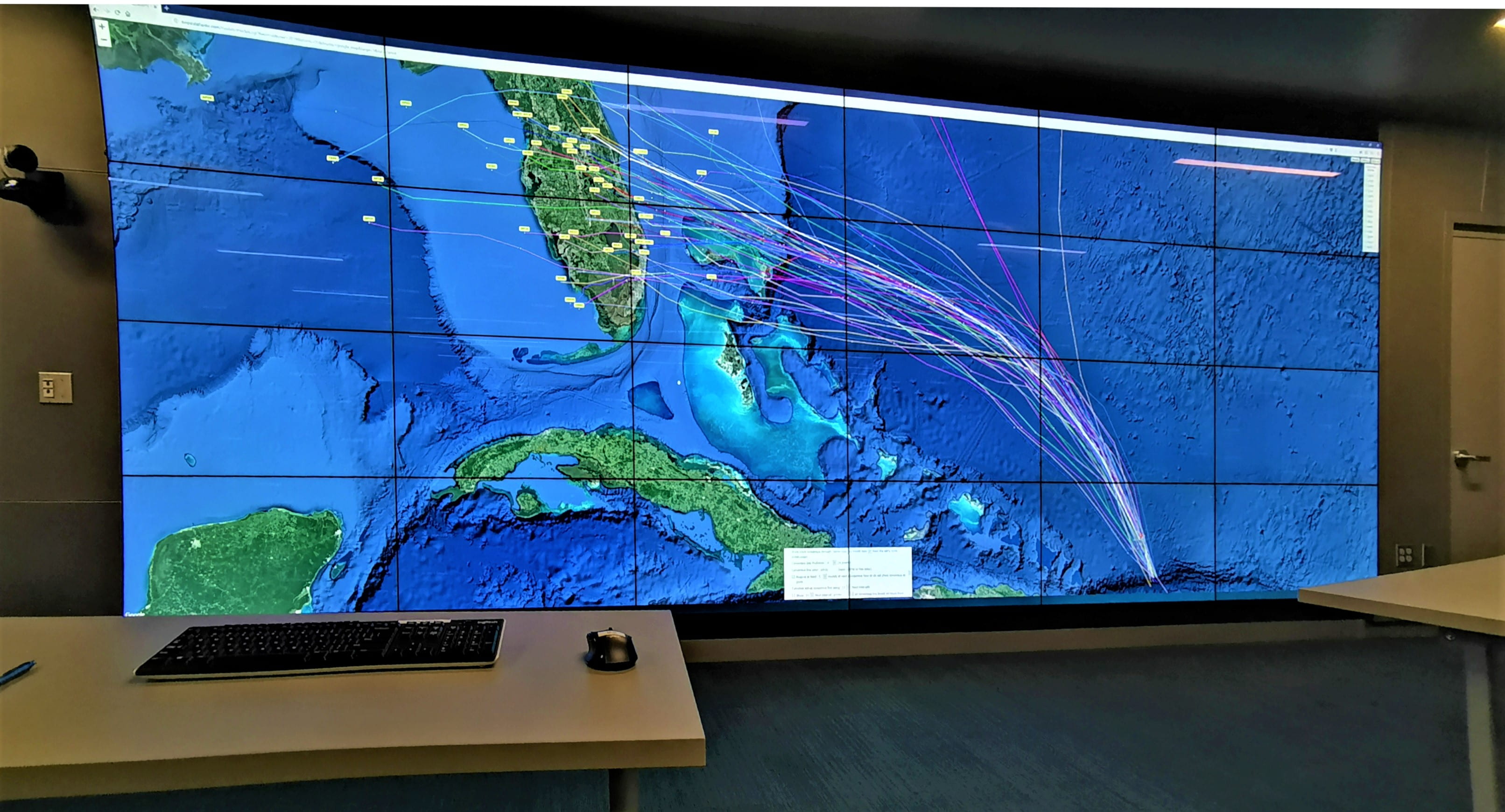
One of the very cool things about being in the Price Science Commons at the University of Oregon is access to the 50 Million Pixel Visualization Wall. It is great for viewing global events. Hurricane Dorian is no exception. NOAA, the National Oceanic and Atmospheric Administration, provides data for various storm/hurricane models. A viewer can be used to project all of them onto a high-resolution map. The image above shows about 45 separate models with one consensus model. In this case, the combined data currently show a direct hit on the Kennedy Space Center. Let’s hope they can protect their rockets.