 Ideal habitat sites for Northwestern Pond Turtles will have both suitable aquatic habitat and terrestrial habitat within 500 yards of aquatic habitat. The habitats should have the characteristics listed above. Terrestrial habitat is required for movement between aquatic sites, nesting, and over-wintering and is the most specialized and limiting component of NWPT habitat requirements. Restoration of potential terrestrial habitat could provide significant assistance towards building healthy turtle populations.
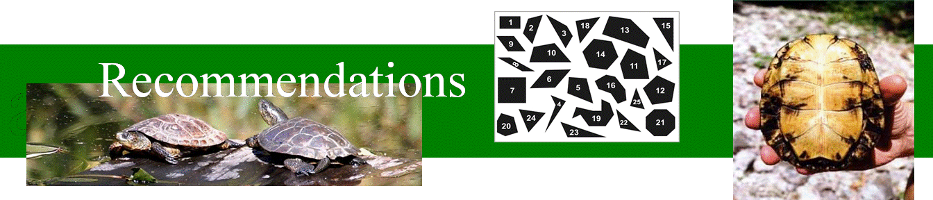
When making our polygon recommendations three key criteria were considered: 1. total square ft of habitat present 2. whether aquatic and upland habitat were found together and 3. the quality of the habitat. A high and potential priority was assigned to polygons that contained adequate amounts of good aquatic habitat. A high priority classifies a polygon with both exceptional aquatic and upland habitat that would require little, if any, restoration to become optimal turtle habitat. A medium priority was assigned to polygons with exceptional aquatic habitat that may be lacking in upland habitat or require removal of blackberry or other more strenuous restoration.
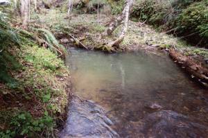
 High Priority Polygons ·CG08 contains both a 4th order and 5th order stream, both with exceptional aquatic and good upland habitat. There were 13 aquatic features totaling over 35,500 sq ft, split between these 2 stream reaches. All features were complete with basking structures and large, deep, and slow pools. Good sun exposure and a variety of upland habitat features within the polygon.
 ·CG14 contains an order 5 stream with both ideal aquatic and upland habitat. All pools are large and complete with quality basking structures with relatively little canopy closure. Pools contain both deep and shallow sections. Undergrowth is not thick, allowing good upland habitat with dirt soil, short grass, and no blackberry. Some of the upland features are located adjacent to aquatic features.
·CG07 contains multiple smaller pools within a 4th order stream. The aquatic habitat totals 1,715 sq ft placing it 12th out of 33 polygons; however this polygon contains numerous ideal upland habitats. Six upland sites were recorded, three of which are located adjacent to aquatic habitat.


·CF 13 contains an excellent chunk of upland habitat 300×70 ft long extending beyond the polygon border
 approximately 100ft, and about 65 ft away from 5th order stream with 3 adequate aquatic sites totaling 3,300 sq ft. 2 of the 3 sites did not contain basking structures, but all sites were fairly deep and had good sun exposure
·CF15 contains three large pools off an order 6 stream. Each pool was equipped with basking structures and estimated about 50% canopy cover. Sites 1 and 2 were found close together totaling 1,250 sq ft and site 3 alone held over 9,000 sq ft of aquatic habitat. There was no upland habitat recorded for this polygon, but sandy stream banks and loose duff soils make this site ideal for creating upland by reducing canopy cover.
Medium Priority Polygons
·MK21 contains good habitat features next to swift moving main channel of McKenzie river (stream order 7). Pools are secluded and are mainly back-channels, but may not exist in non-flood events. One corresponding upland habitat was found near an aquatic site.
 ·LC01 contains 9 small aquatic features. Fast moving water between features and along the outside of many features. No viable upland habitat. Beige spots on map were inaccessible to turtles and not viable. Blackberry removal from adjacent stream banks needed to create viable upland habitat.
·RR59 contains good aquatic habitat with large pools and good basking structures. However, there is no adequate upland habitat due to steep topography. Beige area is overgrown and steep.
·RR73 contains large areas of upland habitat without corresponding aquatic habitat. Two upland sites close to creek, but no decent aquatic habitat. Creek was to narrow, shallow, and probably to fast for turtles with no good pools and underbrush growing right up to bank. Aquatic restoration needed.
Our survey resulted in high aquatic to upland habitat ratio. Our recommendations primarily focus on upland habitat restoration. However, it was observed that sites with power lines contained large open areas of potential upland habitat, and that efforts to create aquatic habitat near these areas may be beneficial. Primary restrictions for upland habitat were steep topography making habitat either inaccessible to turtles or to steep for nesting; blackberry or heavy vegetation along stream banks; or rocky upland soils (rocky upland areas were primarily old roads or turn-rounds designated by the beige areas on the map). Himalayan Blackberry was the primary invasive plant species limiting potential terrestrial habitat in each region. Focusing restoration efforts on invasive species removal would add a substantial amount of WPT usable terrestrial habitat.
Though we encountered a considerable amount of WPT potential habitat, we did not encounter any Western Pond Turtles on BLM land. A survey designed primarily to assess current Western Pond Turtle use areas would further clarify which locations and restoration efforts may benefit local WPT communities.