Project 4 Outline: LTD SMRT Project (Safe Monitored Rider Transit)
by Connor Shields and Dylan Molnar
GEOG 491: Transportation Sensors and the Smart City
Ken Kato and Jacob Bartruff
Introduction
The proposed new LTD public transportation system uses people counters on the bus system to get an accurate measure of rider tendencies across different routes at specific times. Each bus will be equipped with two sensors which will generate numeric data no larger than 4 bytes of memory at any given time. The data will then be wirelessly transferred to LTD headquarters once per minute. Having this information will allow LTD to more efficiently plan their bus routes, which will create a safer and more comfortable public transportation system.
To successfully perform this project, we have developed a system to accurately record how many people are on a given bus at any time and location. This inexpensive method, is accurate, requires little setup, and does not take up much space. For example, it would replace older methods of people counting that usually consist of an individual taking notes with a clipboard. The sensor system will keep track of when people enter or exit the bus and record the data. The sensors use IR beams that will reflect off of the passenger’s clothing. Direction is detected because the Arduino board has two IR sensors placed side-by-side and are able to determine the direction of the person by the order by which the IR beams are reflected back.
After completing of the project, LTD will be able to redesign their route system based on actual usage data from their buses. Data will document ridership usage 7 days of the week at both peak and low-use hours of operation. Often buses are overcrowded at high-traffic commute times, but can be nearly empty at other times of the day. Not only is overcrowded transportation a safety and comfort concern, under crowded bus transportation is inefficient and potentially detrimental to the environment. This project is able to supply the LTD transportation network with the data that is needed to assist in the structuring of a sustainable transportation bus system in Eugene and Springfield that safely and efficiently transports members of the community.
The LTD SMRT project has the ability to connect an invaluable transit system to those it serves through the smart use of sensor technology. Once installed, the sensor network has the power to communicate user populations of each bus, informing that transit system to pursue its mission with efficacy and efficiency. This project is geared towards transforming the Eugene/Springfield community into a smart city, which uses investments in technologies to better run the city. These investments, in theory, will create more efficient, sustainable and safe infrastructure for the residents.
Context
The current state of safety in public transportation has been researched but continues to have a need for adaptation because of the changing dynamics of transportation. We noticed there is significant literature about what it means to be overcrowded and what the concerns are with overcrowded transportation. Overcrowded public transportation can be problematic due to safety concerns. The primary concerns with overcrowding are stress and injury from the overcrowding itself, dissatisfaction, and the possibility of increased risks in the event of an accident (Li and Hensher, 2013).
In particular importance to us is defining what it means for a bus, or any form of public transportation, to be considered overcrowded. Overcrowdedness can be attempted to explain objectively, like Li and Hensher, or more subjectively, Mahudin. What it means to be overcrowded can be interpreted by different people in different way. For this reason the use of a more objective approach, which aims to understand how the perception of over crowdedness varies, is more achieving for our project. Europe and Australia’s standard for unacceptable crowding is when the number of passengers reaches 4 per square meter. More aptly the USA holds a standard of 5 people per square meter and China’s threshold is 8 people per square meter (Li and Hensher, 2013). Public rail often uses a calculation called load factor, which is the number of passengers divided by the number of seats. For example, if every seat is occupied, the load factor would be 1(Li and Hensher, 2013). This factor can be used to determine if a bus is overcrowded, however, like rail transportation, the load factor varies in significance dependent on how long the distance is traveled.
Unacceptable crowdedness in public transportation is especially a safety concern for the disabled populations within a community. According to the international policy think-tank UITP(Union Internationale Transports Publics), massive communal transit systems are the vehicles for future and present mobility needs. The organization states that “If public transport is to become tomorrow’s mode of choice, public transport operators will need to become true mobility providers and system integrators.” Lowering maximum “safe” occupancies may be a solution to inequality within LTD’s ridership. Within UITP’s Priority Topics page it is written that “public transport needs to do more to stay in sync with people’s changing behaviours and evolving lifestyle habits. This can mean reconfiguring vehicles to free up space or even a fundamental network redesign, to actively seek out mobility demand line by line, district by district”. The popular belief that transport systems are slow or unresponsive to rider’s mobility and accessibility demands gives transportation authorities reason to solicit technologies and research that can visualize inefficiencies. Studies such as the one being proposed can advance understanding of riders’ demands and requirements for safe transport.
Our projects primary objective to is efficiently and cost-effectively record usage of the LTD bus system and visualize this data for LTD in a way that could aid making decisions on increasing the safety of riders, one way or another based on project observations.
Objectives and Goals
The following questions will guide the process and potential outcome of the Lane Transit District ‘SMRT’ (Safe Monitored Rider Transit) Bus Safety Capacity System.
Are LTD bus routes permitting overcrowded and otherwise unsafe conditions for riders at peak hours of operation?
Do ‘safe’ maximum occupancies exist within the public transit community?
Could a safe maximum occupancy of LTD buses be established via a people counting sensor that accounts for time of day?
If rider safety is being compromised, what is the cause of overcrowded conditions at peak hours of operation?
Intended Outcomes:
1. Enable LTD staff to visualize bus capacity in near real-time
2. Identify a standardized ‘safe maximum occupancy’ of bus types within the LTD fleet based
on established metrics in related literature
4. Equip LTD with a data-communicable bus fleet
5. Allow LTD to both evaluate safety and efficiency of current route schedule and make amendments if so desired in concert with compiled rider count data
6. Allow LTD to have access to rider usage of all of the their bus lines and use to aid future decision making
Scale and Scope
The goal of this project is to provide LTD will rider usage data from every bus in there fleet, which will allow them to schedule the number of buses at a given time, the size of the buses at a given time and schedule more efficient bus times for specific spots. The scope of this project is the entire Springfield/Eugene area and will measure every active bus, giving the schedulers a permanent and detailed dataset of rider usage.
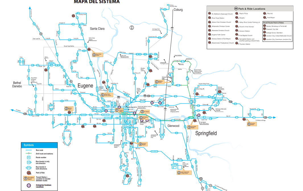
Knowing crowdedness of the entire LTD bus system will be a unique network that will allow for real-time, continuous full coverage. This project can be easily replicated in different cities because of its simplicity and low cost. Within reason, it could also be replicated across other types of public transportation. The scope and scale of this project are specifically concentrated on bus transportation in the Eugene/Springfield area, but this project has potential to impact the entire sector, creating safer and more efficient public transportation.
Sensor
Network
Broadly, the SMRT project aims to create a data-driven constellation of near-real-time sensors communicating individual bus rider counts to LTD’s Eugene downtown headquarters. One complete sensor network (of many) will include 2 Arduino Uno units measuring rider count at both bus door thresholds, 2 Wifi Shields to transmit rider count data to a wireless router fixed to the bus ceiling which then carries the data across a wireless connection to the LTD server for data visualization and analysis.
Ontology and Process
Each sensor (bi- and single-direction) will have a table encoded within its FLASH memory for each Infrared beam which will be actively amended as counts increase. Each count will be attributed with its respective minute, hour of that day in the form of a 4 digit time value (ex. 16:23 or 4:23PM).

Source: http://www.instructables.com/id/IR-laser-person-counter/
After 1 minute elapses of counts the previous minute’s total counts will be saved to a separate memory device attached to the sensor (250Kb SD card). With the route number identified within the sensor’s internal memory, a continuous clock will allow for preciseness in data analysis.
Once per minute the data that has been collected will also be transferred from the Arduino Uno via an Arduino WiFi shield. The shield will then feed the count data from the previous minute to the wireless D-LINK DIR-510L router, fixed to the ceiling of the bus. Each bus’s router will then be calibrated to communicate with the LTD server residing at the downtown Eugene Station location.
The WiFi on each bus will be an added cost, but the benefits, are more than just sending real-time data back to the headquarters. Allowing riders to access the wifi is a benefit many of the riders would enjoy. Also, the password to login could be a quick survey question on where someone is going to and from. This would give us more information on the details of people’s travels so LTD could better serve their needs.
Once on the server, the entire route network’s live rider populations may then be visualized in two time intervals: hours and minutes, separately. Real-time web applications would not be out of the scope of the data and infrastructure. Simple live-web maps similar to Nick Martinelli’s map of public transportation in Portland would be a feasible addition to the SMRT project. Creating a mobile application interface for riders to access via their smart phones is a possible outcome as well. Data availability on the client (rider) side of the system would allow potential riders to know the next scheduled bus’ occupancy and plan their travel plans accordingly.
Components and Budget
Costs have been calculated for sensor parts, 1 whole bi-direction sensor, 1 whole single-direction sensor, and the proposed collective of sensors across 28 transit vehicles.
Sensor 1 (“Front”)
Total = $107.18
Parts include: (1) Arduino Uno microcontroller @ $24.61
(2) BESTIM Photoresisters GL5528 @ $ 0.38
(2) 3-volt 1mW 650nm red Laser Diodes @ $3.39
(1) 5-volt L7805 Voltage Regulator @ $0.65
(1) VKTech ‘PCB Universal’ Circuit Board @ $0.80
(2) Esunpal 10K Ohm Resistors @ $0.14
(1) Giftkun 3296W-102 1K Ohm Trim Pot @ $0.43
(1) Panasonic 9-volt battery @ $1.04
(1) AspenTek 2.1 Clip Snap 9v Arduino Connector @ $0.89
(1) 12C EEPROM w/ 256K bit storage (external memory) @ $1.85
(1) Arduino WiFi Shield @ $73.00
Sensor 2 (“Back”)
Total = $105.23
All components are the same as Sensor 1 with the omission of:
(1) BESTIM Photoresistor GL5528 @ $0.19
(1) 3-volt 1mW 650nm red Laser Diode @ $1.70
(1) Esunpal 10K Ohm Resistor @ $0.07
(1) Arduino WiFi Shield @ $73.00
Sensor Couple (1 “Front”, 1 “Back” + wireless router)
- (1) D-Link DIR-510L portable wireless router @ $100.00
Total = $312.41
Mounting materials
3-meter Scotch Exterior Mounting Tape @ $3.47
(112) generic plastic ware pieces to protect sensors ≈ $60
Data Visualization
The visualization of the data will have be clear and concise, which will allow it to be easily read and interpreted by the staff who make decisions. If they are given a dataset that is presented in a way that is easily understood, the decision making process is given quality and accurate information.
Graphs, charts and maps will all be used to display the data. Programs, like tableau, excel, and illustrator will be used to visualize the data and give it meaning. Connecting to other demand information like events, sporting games, festivals and breaks will allow more background information on why people use public transportation and how to better cater to their needs.
Visualizations are important because they make what would otherwise be complicated, and potentially useless data into information that is used to make important decisions. Our visualizations will be aimed towards helping bus route scheduling and creating accurate and visually appealing graphics for the public (who financially support LTD) and policy makers that approve of further investment in the public transit infrastructure of the Eugene/Springfield community.
Concerns — Privacy, Security, and Morality/Project in general
Location Data can be a sensitive topic. We take the privacy concerns of people seriously and that is why with this project we are not interested in specifics about an individual. This project is solely focused on counting numbers to increase safety on the LTD public transportation. However, we have realized that location data can be sensitive and locations of people can be attached to other data in a way that makes it no longer anonymous. For example, because we are measuring rider count, if the numbers are low at certain times each day, but there are consistent patterns throughout the week, background information on people can be attributed to this rider data which can individualize the results. A concern that has been brought to our attention is if someone were to ride a bus everyday at 8:00AM while no one else is on the bus, the rider count would be one. If we learned where this person was getting off we would also no where that individual got onto the bus. If the person viewing the data has seen who rides the bus then, they now know there daily commute and this raises privacy concerns.
While analyzing the data we will do our best to keep the data anonymous, but there will always be concerns when location of individuals is involved. In the end, this project is concerned with providing customers of LTD the safest and most efficient service possible and is not interested with their personal information. We hope that this project’s transparency creates trust from the riders and provides a great experience.
Issues with project
Although we have full confidence in the project we acknowledge that their may be some areas for concern. We will go through the concerns briefly. The router that is installed on each bus is battery powered and without frequent inspections, may go out and need to be replaced. This outage would cause a black-out in the data. Another aspect, concerning the IR beams, lies in the issue of miscounts with multiple, simultaneous passengers crossing the same beam. We are not positive the system will be able to make two counts if people walk side-by-side onto or off the bus. Also, for small children and babies, if they are being carried they will not be counted, and if they are too short they will also not be counted. The sensor will likely be installed at a height of three feet to enlarge our data capture.
Conclusion
This indefinite project looks to supply ridership data for analysis to LTD, so they can redesign their bus routes based on rider demand. Making these changes will allow for safer bus travel, more efficient routes, more efficient use of larger/smaller buses and will help contribute to lessening the communities impact on the environment due to better scheduling. The system is relatively inexpensive and requires little start up time and data processing, so it would be easily transferrable to other public transportation systems in different cities. On a larger scale the impacts would affect more people’s safety and further help the environment as reductions in emissions would be more significant.
In the future, we hope to make the results of the people counter live fed to a small screen for the bus driver. The driver would then be able to at all times know how many people are in the bus and when it is close or reaches capacity. We think a real-time application of this data is reasonable and useful.
Although people counting in transportation is not new, this project’s end goal of providing a real-time people count to both bus drivers and LTD staff along with collecting usage data efficiently at a low cost and the use of unique sensors is something to our knowledge is unique. The project is built in a way that it could easily become widespread and implemented across not only bus systems but many other public transportation systems (trains, light rail, subways, etc.). The safety implications of having such accurate and useful data collected at a low cost will advance public transportation networks to the point where they can have efficient routes that are scheduled based on actual use. It is exciting because these impacts could be spread not only across bus systems but could reach into the other public transportation systems as well.
The LTD SMRT project holds prospect for enhancing the quality of life for Eugene and Springfield riders. Smart cities use technology to provide better services to the members of the community and use their tax dollars on infrastructure they use. Public transportation is important in preserving the environment, so it is crucial to have the the system efficient and safe, in turn creating an environment that is focused on sustainability.
REFERENCES:
http://playground.arduino.cc/Code/SimpleMessageSystem
http://datasheet.octopart.com/A000066-Arduino-datasheet-38879526.pdf
http://www.arduino.cc/en/Main/ArduinoEthernetShield
House of Commons. Transport Commttee. Overcrowding on Public Transport. Session 2002-03., Seventh Report. London: 17 Sep. 2003. Online http://www.publications.parliament.uk/pa/cm200203/cmselect/cmtran/201/201.pdf
Li, Zheng, and David Hensher. “Crowding in Public Transport: A Review of Objective and Subjective Measures.” Journal of Public Transportation 16.2 (2013). Institute of Transport and Logistics Studies. Web.
Mohd Mahudin, Nor Diana: Cox, Tom; Griffiths, Amanda (2012) Transportation Research Part F: Traffic Psychology and Behavior vol. 15 (1) p. 38-51
UITP. “Priority Topics.” Internationale Transports Publics. Web. 6 May 2015.